Drive Weather App
Sport Touring Corner
By Norm Kern
If you are doing day rides or multi-day trips, wouldn’t it be nice to have an app on your phone that lets you put in a route, then shows you what the weather will be at points along the way when you reach them?
For years I used a web site called get-there-dry.com. It helped me countless times to avoid rain and other bad weather while riding, but this year it disappeared from the web. Fortunately we live in a world where there is a phone app for everything, and I found an even better app, Drive Weather, which is available as a free download for both iPhone and Android.
Drive Weather is the brainchild of entrepreneur Paxton Calvanese. Go to your phone’s app store right now and install it so you can follow along- you’re going to love it!
On the main screen you will see a Google map.
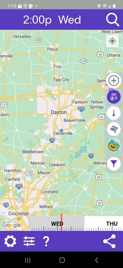
You can pan and zoom it like any other app. The most popular use of Drive Weather is for travel- To see how this works, click the magnifying glass icon at the top right of the screen to open the search panel.
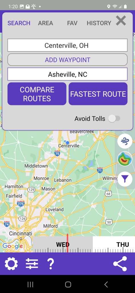
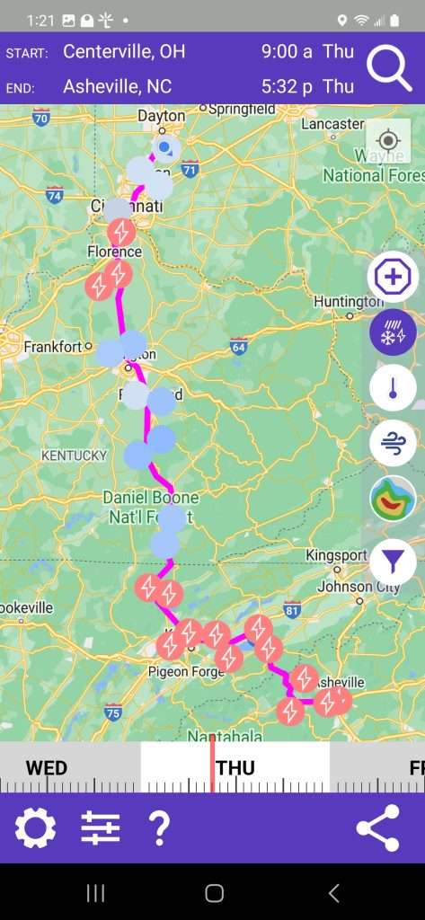
Enter your starting and destination cities. (You can enter additional waypoints and stops in the PRO version.) Select FASTEST ROUTE. The app will collect data and display the route with symbols that show weather conditions along the route at your expected time of arrival.
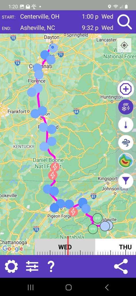
Simply move the time slider near the bottom of the screen to see what the conditions will be at different starting times.
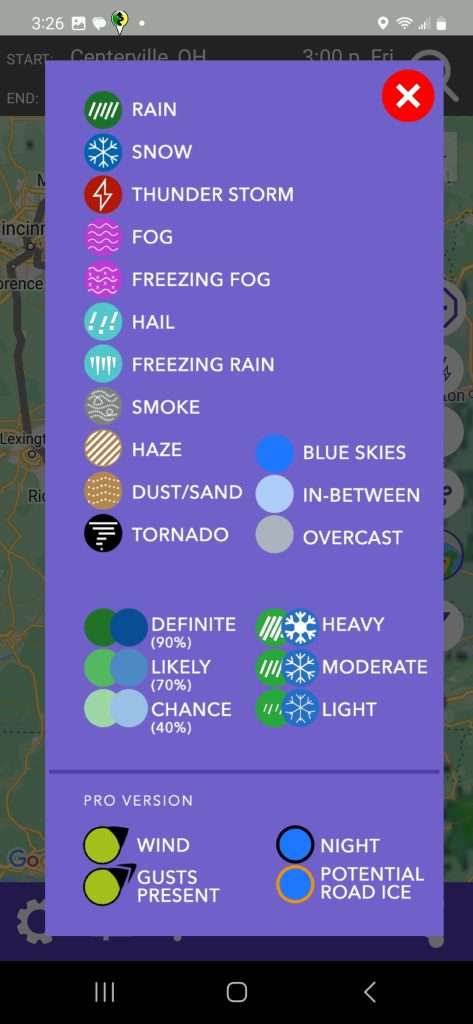
To learn what the weather symbols mean, click the question mark at the bottom of the screen.
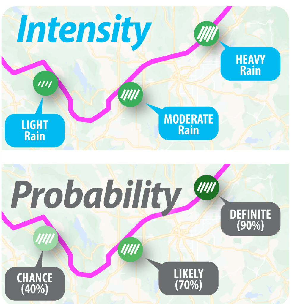
Many symbols have dual function- the line thickness of the rain, snow, etc. symbols indicate intensity, while the lightness or darkness of the background color indicates likelihood.
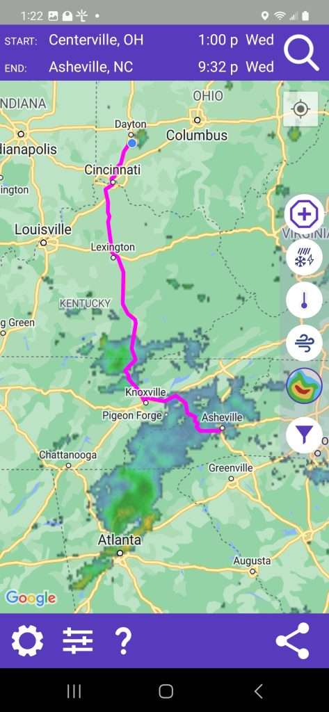
There are several icons along the right side of the map screen. Below the default weather button there are buttons for temperature, wind and current radar.
The AREA WEATHER function is handy for a quick check if you’re going on a ride to see if there’s better weather in a particular direction or want to know how warm to dress for the ride. Weather symbols appear on the map in about a 100 mile diameter circle around your location, and the time slider and side buttons work normally.
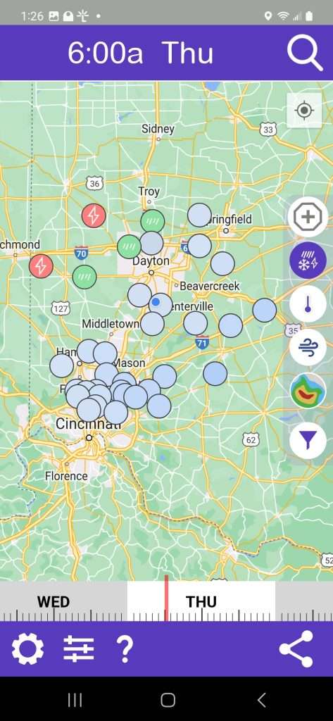
The time slider lets you look up to two days ahead. (Seven days on the PRO version.)
Dew Point
If you select Motorcycle as your vehicle in Drive Weather settings, you get the added option to view the dew point along your route, just like for temperature.
Why pay attention to Dew Point? When people talk about comfort levels, you will sometimes hear them say, “It’s the humidity, not the heat.” That is true because although heat plays a major role in causing hot conditions, dew point and relative humidity are the elements that actually determine your comfort levels.
Here’s how to interpret dew point for motorcycle riding:
< 60° F Pleasant- air feels dry and crisp.
~ 65° F Getting sticky
~70° F Uncomfortable
>75° F Intolerable, possible danger of heat stroke.
Last tip:
The quickest way to learn the Drive Weather’s features is to click on the gear icon in the lower left corner of the screen to go to the settings page and play the Quick Start Video Guide. This page is also where you will find app settings, subscription info, etc. Enjoy!
——————————————————————–
Connect with local Ohio MSTA riders at these monthly breakfasts:
Southwest Ohio Breakfast, 9AM August 19
Village Family Restaurant
144 S. Main St.
Waynesville, OH 45068
Central Ohio Breakfast, 8AM, September 6
Portside Cafe
6515 S High St
Lockbourne, OH 43137


